GALLERY
On this page we present some imagens, videos, drawings, and other stuff about our research. This is divided by sections that correspond to case studies and experiments. In order to browse through VRML models you should download and install cosmo player.
> Terrestrial Laser Scanning
> Structure From Motion
> Low-cost photogrammetric methods
> Heritage Information System
Terrestrial Laser Scanning
Terrestrial Laser Scanning is a fairly recent technology. It is an active technology that uses laser light to measure. There are three types of systems: time of flight, phase comparison, and triangulation. Time of flight and phase comparison systems are best suited for the production of documentation of buildings and triangulation systems more suited to smaller-scale objects. Below are some images and vídeos of the case studies where that have been applied such techniques.
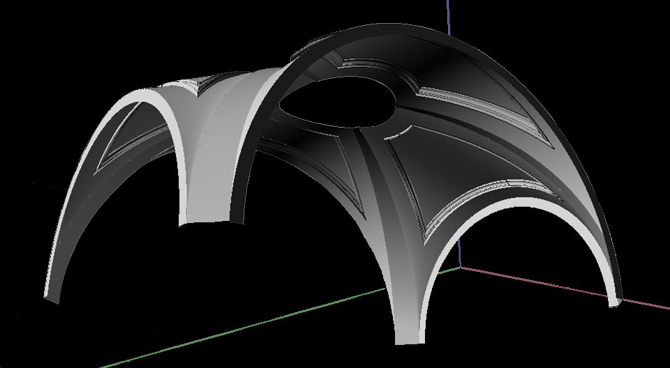
Arco of Rua Augusta
The 3D laser scanning survey of the Arco of Rua Augusta was integrated in the participation of FAUTL as a Consultant entity in the architectural conservation project. The responsible for the conservation project of the Arco of Rua Augusta was the architecture office Atelier 15 directed by the architects Alexandre Alves Costa and Sérgio Férnández. This conservation project was commissioned to Atelier 15 by Frente Tejo / Parque Expo, and the participation of FAUTL was integrated in ArcHC_3D research project.

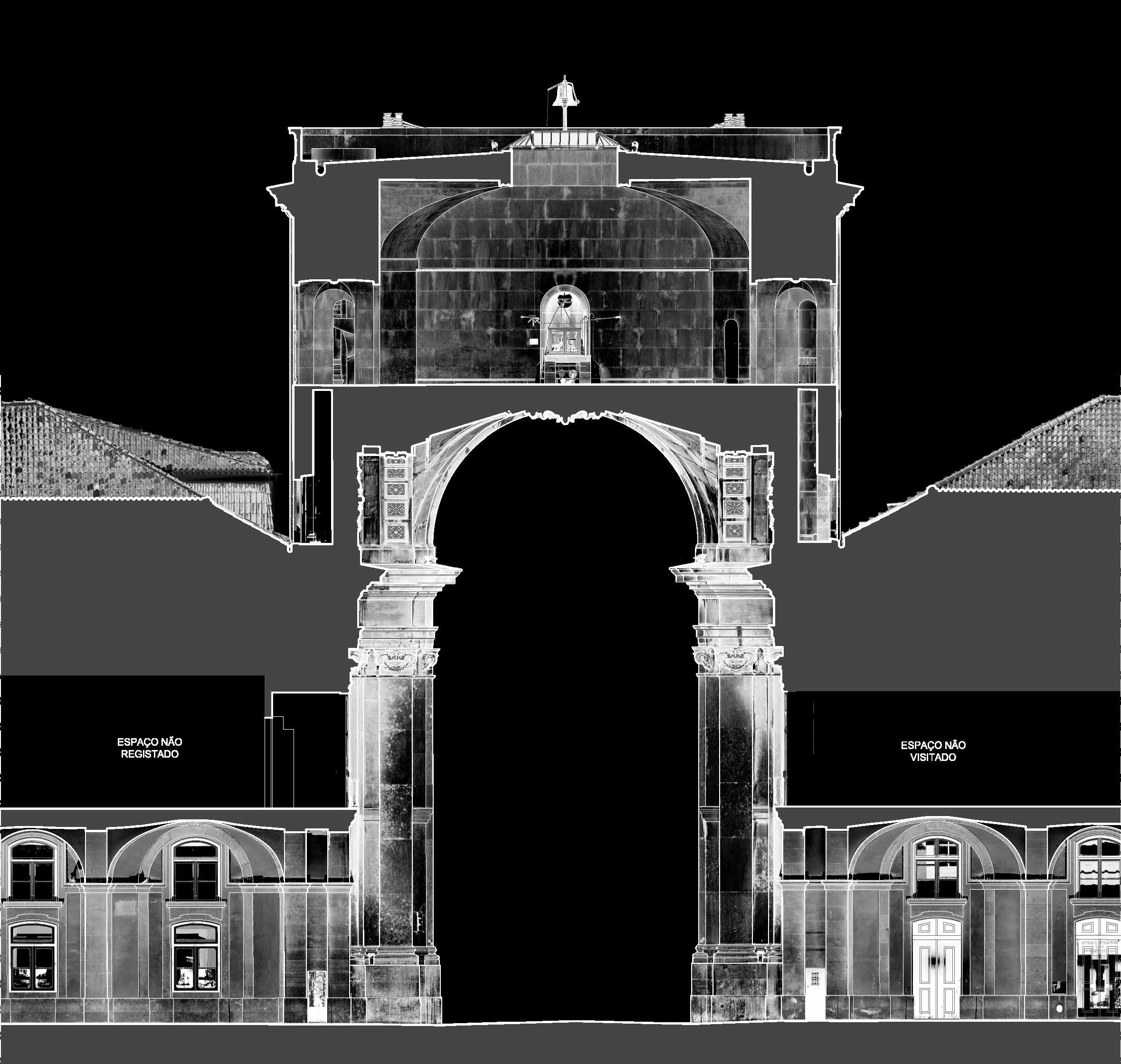
It was explored the fact of having three-dimensional information to improve the quality of measurements of the object and placing hypotheses on the geometry of the construction systems. The following images show what we called selective modeling. That is, modeling directed to specific purposes which need not be full modeling of the building.

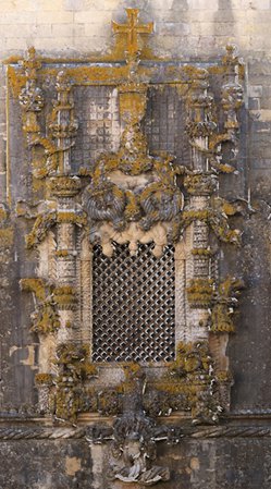
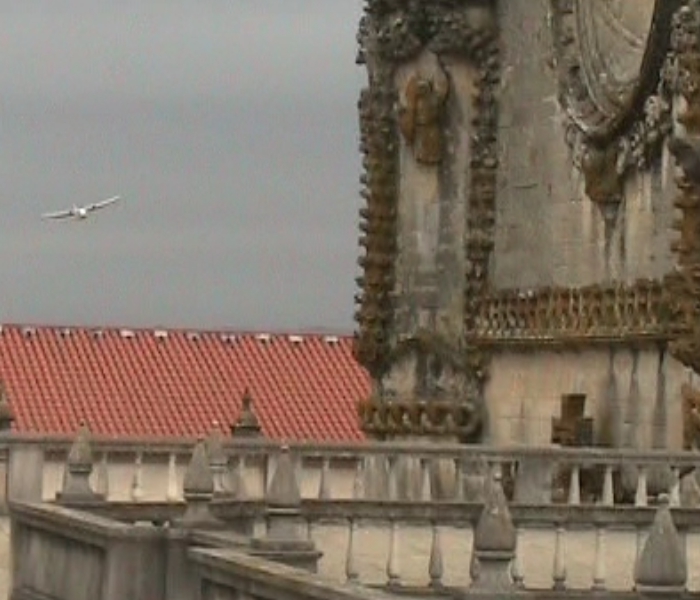
Convento de Cristo
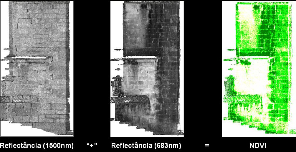
We carried out several 3d scanning surveys in the Convent of Christ at Tomar, namely outside the Nave Manuelina, in the Pátio dos Carrascos and in Paços do Infante. The images shown below refer to the lifting of the Nave Manuelina. This survey was done in order to produce the documentation to serve as basis for the conservation project of stone masonry.
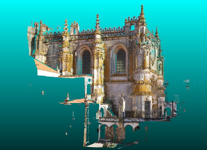
From this experience we emphasize as more relevant the processing of multiple reflectance images of laser scanning to the analysis and diagnosis of anomalies.
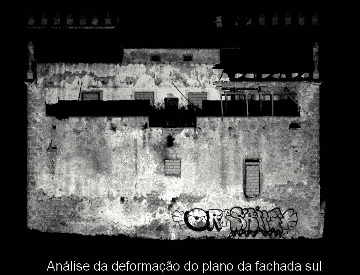
Palácio de Valflores
The palace and Quinta de Valflores are a testimony of sixteenth century Portuguese architecture. With 3D laser scanning survey it was possible to study and analyze the deformation of masonry walls.
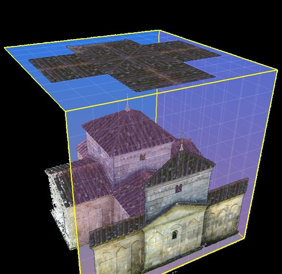
Chapel of S. Frutuoso de Montélios
The chapel of St. Frutuoso of Montélios was the first case study of our research project. In this case we intended to understand the basic operations of laser scanning surveys and to understand the basic workflow for production of several kinds of materials such as textured 3D models, ortho-images and 2D drawings.
<< top
SFM 3D Reconstructions
The acronym SFM means Structure From Motion. It is a photogrammetric methodology to 3D reconstruction from multiple images separated by small base distances. The examples presented here were produced with the SFM toolkitprovided by Henri Astre and Photosynth, and Visual SFM (VSFM) by Changchang Wu. The SFM toolkit is a collection of applications that implements the Bundler algorithm by Noha Snavely and cmvs+ pmvs by Yasutaka Furukawa and Jean Ponce. The first algorithm enables the relative orientation of the images and the latter are MVS (multi-view stereo) algorithms for dense point-cloud generation.
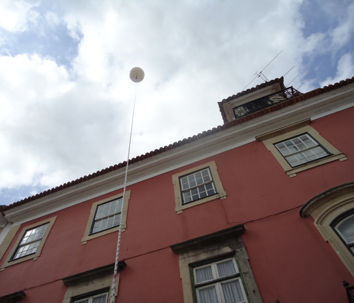
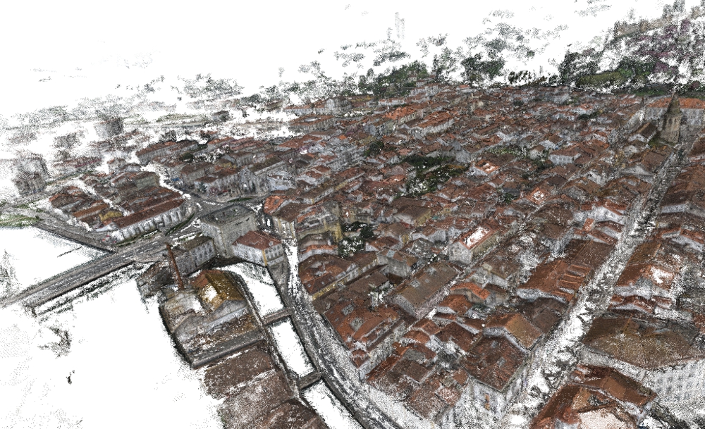
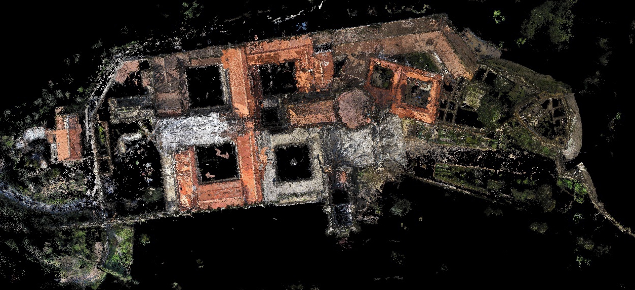
Large scale objects - The city of Tomar and the Convento de Cristo
The following two images represent field sessions of data capture. Both took place in the city of Tomar, Portugal. On the left image we are using a ballon with a camera rig to take aereal images of Tomar historic centre. On the right image we are using an EPS drone to take aereal images of Convento de Cristo.
The following VRML models represent 3D reconstructions done with SFM software. On the left we have a sparse 3D point cloud of the city of Tomar (1154 images). This was done with an SFM toolkit provided in internet by Henri Astre. The yellow dots correspond to ballon stations. On the right we have another sparse 3D point cloud model of Convento de Cristo of Tomar (195 images). This was done with Photosynth.
In the image bellow we have a partial view of a dense reconstruction of the historic centre of the city of Tomar done with the above mentioned PMVS+CMVS.
In the image bellow we have a view of a dense reconstruction of Convento de Cristo at Tomar. The sparse model was done with Visual SFM (VSFM) by Changchang Wu. The dense reconstruction was done with the above mentioned PMVS+CMVS.
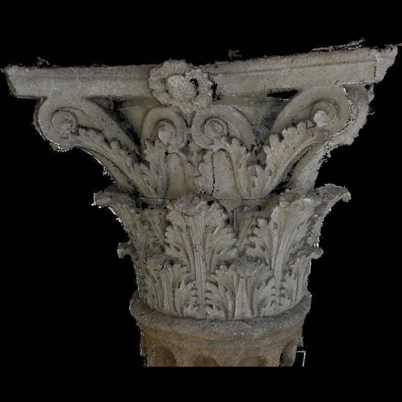
Small-scale objects - a chapiter
This chapiter was automatically reconstructed with 32 images using the SFM toolkit. It is a point cloud model with about 8.6 million points.
<< top
Low-cost photogrammetric methods
For low-cost photogrammetric methods we refer to the rectification of images and drawings. Briefly, the perspective effect is removed of the images via a projective transformation. After this transformation, and put on scale, the image acquires metric properties making it a useful tool of analysis, interpretation and measurement. Below are some images of the case studies where that have been applied such techniques.
Pátio dos Carrascos at the Convent of Christ in Tomar.

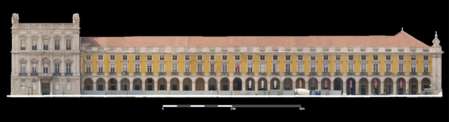
The façades of the blocks of Terreiro do Paço.
<< top
Heritage Information System
The Information System for registration of architectural and urban heritage, accomplishes two strategic goals:
- Provide detailed recording of the cultural heritage;
- Provide information for the management, for project development and dissemination.
The information system was defined with the aim to gather, store,
process and provide relevant information about the heritage recording.
The information system defined for this project incorporates not only the creation of databases to accommodate
the physical and intellectual information, but also has the concern to create,
store and organize digital objects that may be useful in the present and preserved
for future use and the definition of a set of metadata to structure and standardize the information used.
It was decided that the system is based on client-server architecture, accessible
via a web platform with the following basic principles of operation:
- Allow mapping of the existing heritage records, preserving them in
digital format with the utmost rigor and detail as possible;
- To enable its visualization to query and spatial and environmental analysis;
- Act as an element that helps to strength and promote the preservation and valorization of heritage.
For the record and dissemination of heritage, it was developed a web application,
since this platform makes the application independent of the software on each workstation
all stations now have a browser installed) and also because the Internet presents itself as
the infrastructure current structure, most used and most suited to the dissemination of scientific,
cultural and educational, worldwide.
Through this application it is possible for any user (specialized or not) to
have access to a wide range of information about the archaeological and architectural heritage,
photos, graphic documentation, literature and even the 3D models created.
This application is the visible tip of the iceberg,
since the designed information system can support the various processes,
from the collection and storage of data to the study,
processing and visualization, and can feed any portal of buildings and monuments ever created or to be created.
The development of the information system was majorly done by the University of Minho.
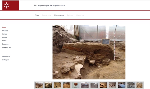
The following image represents the front office application and its menus.
Webmaster:Luís Mateus | © 2011 | Updated: 09/10/2011