3D
In this section it is presented several examples of Architectural Heritage Documentation projects. These correspond to several years of activity of ArcHC_3D research group. We have examples of service providing to community and examples of academic work in the context of teaching and advanced training.
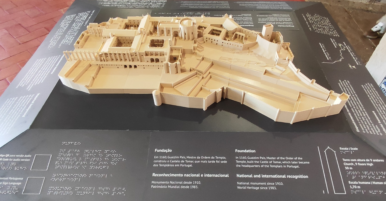
(2022) In the context of the project Tactile models for visual impaired people, we modelled five monuments, four of which are world heritage by UNESCO. The process icnluded the buildings and some of their details or museological content. The process folloed a CAD modelling strategy and photogrammetry.
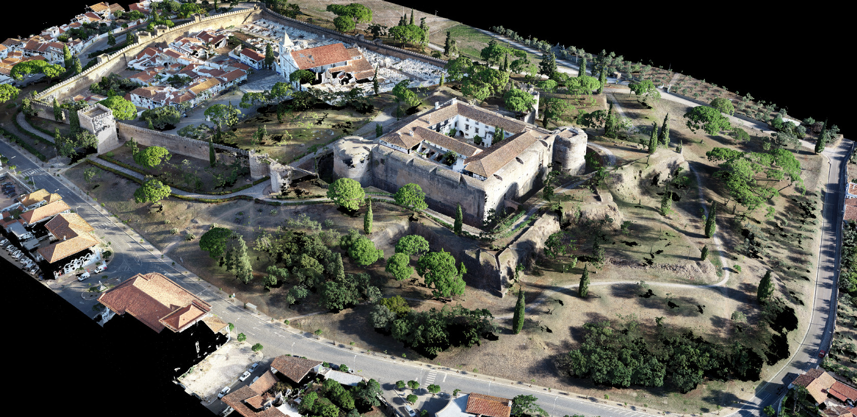
(2022) In the context of the restoration project, surveying of the historical walls and castle of Vila Viçosa.It was done a mixed survey using terrestrial laser scanning (TLS), photogrammetry with drone imagery and ground based imagery, GPS positioning, and topography. the purpose was to produce all the documentation for the restoration project, including landscape documentatcion.
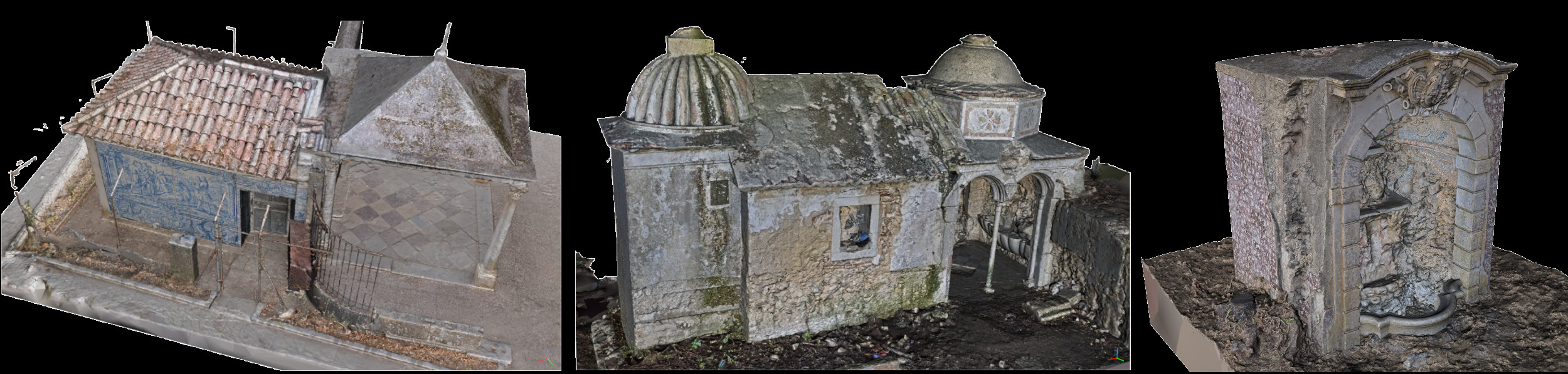
(2021)Surveying of "Oratório do Senhor Morto", "Lapa" and "Fonte dos Embrechados" in "Quinta da Piedade", including the terrain. It was done a mixed survey using terrestrial laser scanning (TLS), photogrammetry with drone imagery and ground based imagery, and GPS positioning. The main purpose was the delivery of ortho-imagery combined with CAD documentation, textured 3D models and videos. This was a colaboration with Pedro Pacheco Arquitetos included in the restoration project. The final client was the municipality of Vila Franca de Xira. Participants: Luís Mateus, Victor Ferreira, Miguel Rafael.
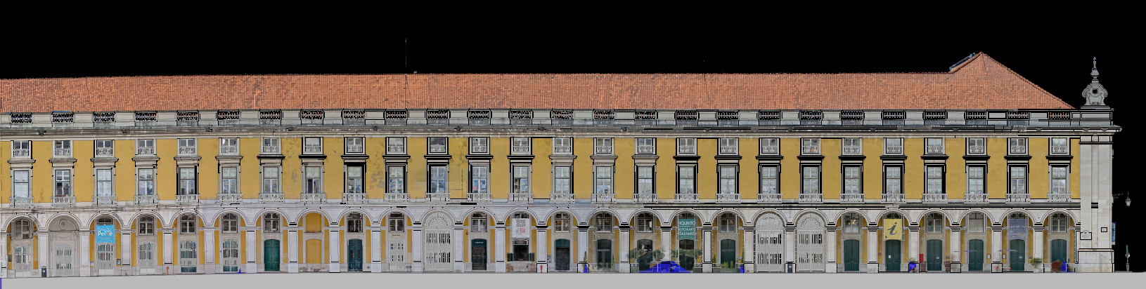
(2021)Surveying of the facades and roof of "Ministério da Agricultura" facilities. It was done a mixed survey using terrestrial laser scanning (TLS), photogrammetry with drone imagery and ground based imagery, and GPS positioning. The main purpose was the delivery of ortho-imagery combined with CAD documentation. Participants: Luís Mateus, Victor Ferreira, Marta Marta Orszt, Miguel Rafael.
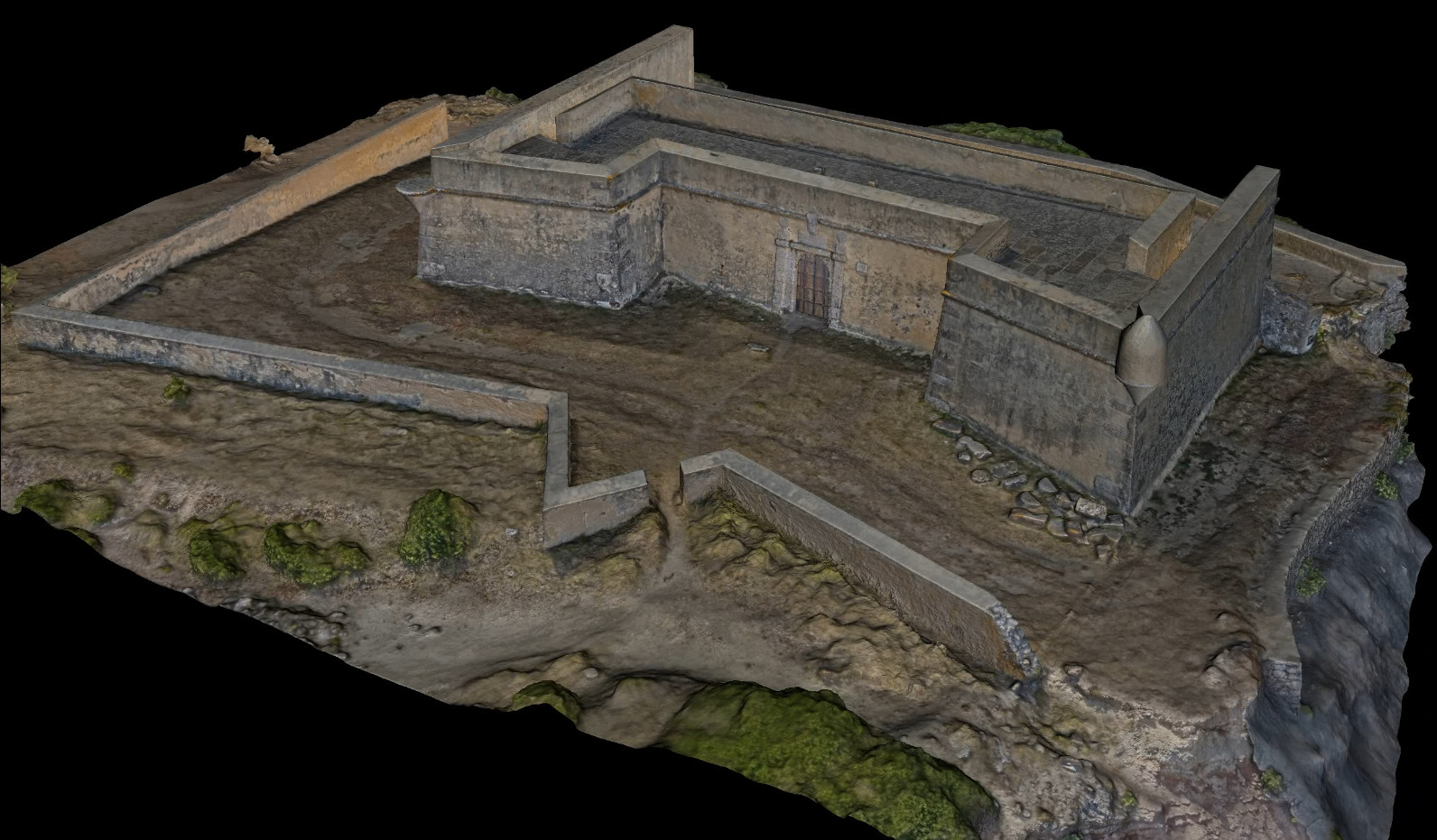
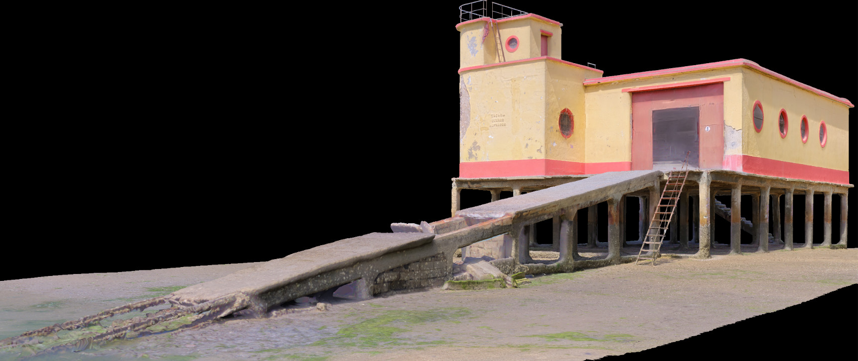
(2021) Surveying of "Forte de Paimogo" in Lourinhã, including the underground cistern. It was done a mixed survey using terrestrial laser scanning (TLS), photogrammetry with drone imagery and ground based imagery, and GPS positioning. This included the production of 3D point clouds, 3D textured models from exterior, interior and cistern, ortho-imagery, videos and CAD drawings. The activity was framed by a cooperation protocol, for academic research, between FAULisboa and the municipality of Lourinhã. Participants: Luís Mateus, Victor Ferreira, Marta Orszt, Graziella Del Duca, Miguel Rafael.
(2021) Surveying of the "Quinta do Paço dos Duques" in Tentúgal. For the terrain survey it was used photogrammetry with drone imagery. For the geometric survey of the buildings it was used terrestrial laser scanning. All the data was georreferenced using GPS. The purpose was the delivery of ortho-imagey of the terrain and geometric data of the buidings. This was a colaboration with Pedro Pacheco Arquitetos included in the restoration project. Luís Mateus, Victor Ferreira, Jorge Fernández.
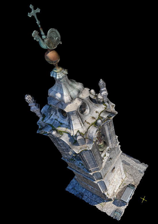
(2021) Surveying of "Torre do Galo" in Ajuda, Lisbon. It was done a mixed survey using terrestrial laser scanning (TLS) and photogrammetry with drone imagery. This was a cooperation protocol, for academic research, between FAULisboa and the company Arquitectando, Lda. The activity was included in the diagnosis report of "Torre do Galo". Participants: Luís Mateus, Victor Ferreira, Jorge Fernández.
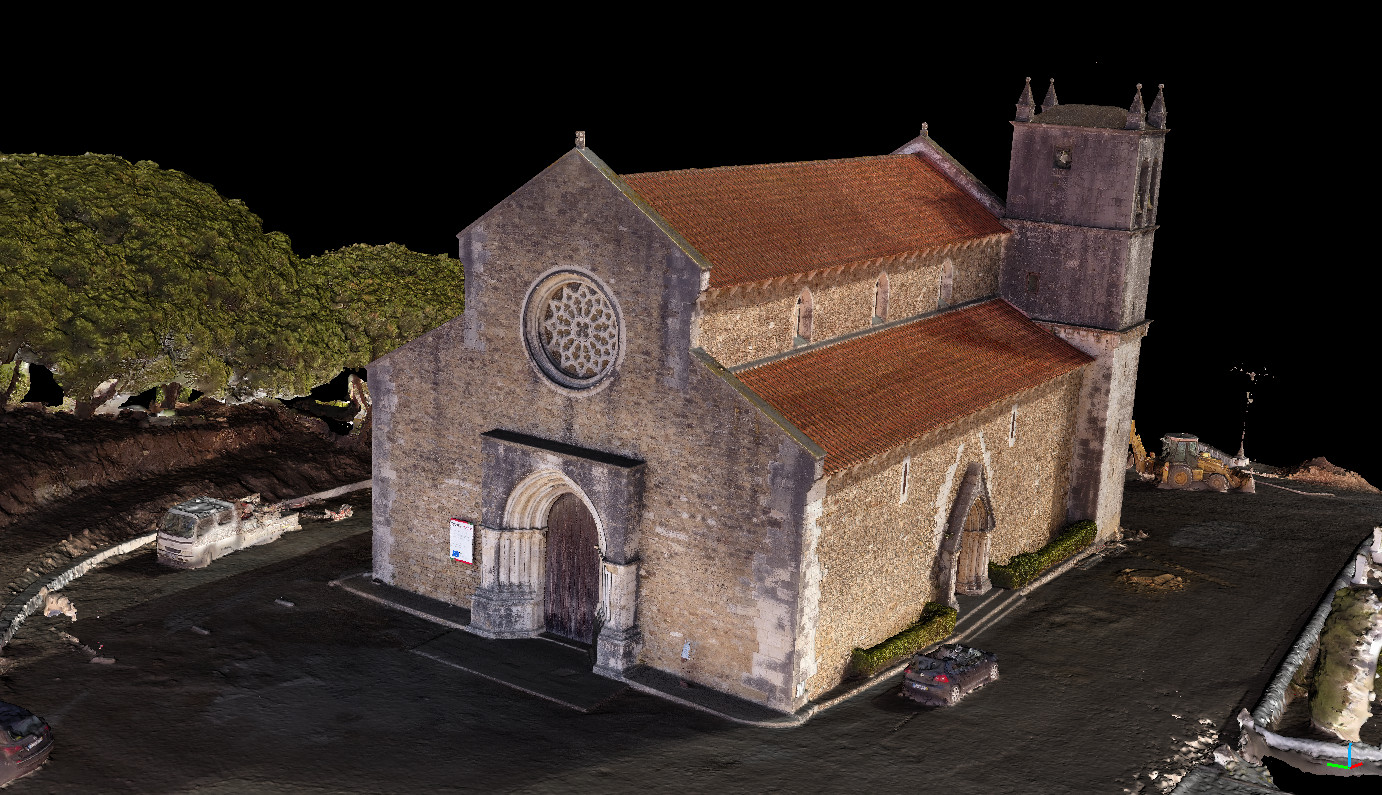
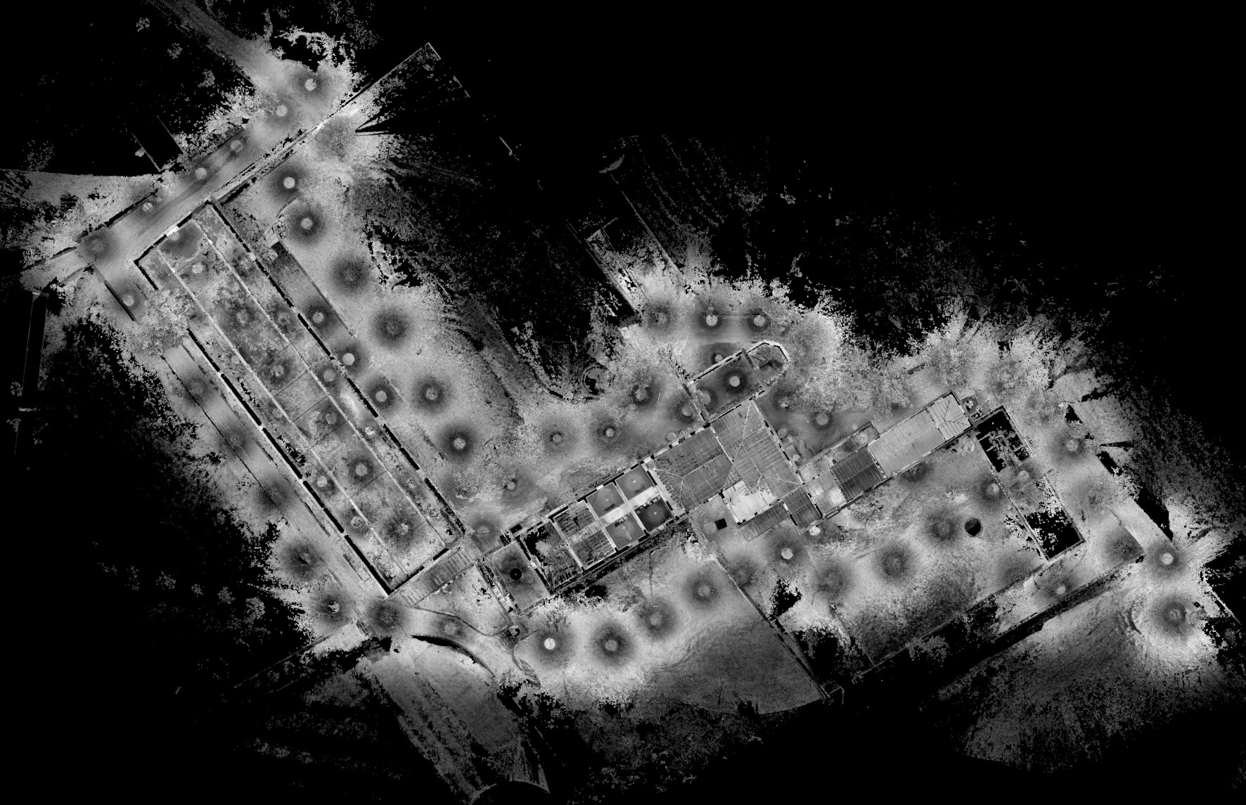
(2021) Surveying of "Igreja do Castelo" in Lourinhã. It was done a mixed survey using terrestrial laser scanning (TLS), photogrammetry with drone imagery, and GPS positioning. This included the production of 3D point clouds, 3D textured model, ortho-imagery and CAD drawings. The activity was framed by a cooperation protocol, for academic research, between FAULisboa and the municipality of Lourinhã. Participants: Luís Mateus, Victor Ferreira, Marta Orszt, Miguel Rafael.
(2021) Surveying of Fuzeta's ISN building, Algarve. It was developed a method to merge survey terrestrial laser scanning (TLS), photogrammetry with drone imagery and BIM modelling, in a single textured model. This was a cooperation protocol, for academic research, between FAULisboa and the company Arquitectando, Lda. The activity was included in the restoration project of the building. Participants: Luís Mateus, José Aguiar, Graziella Del Duca, Victor Ferreira.
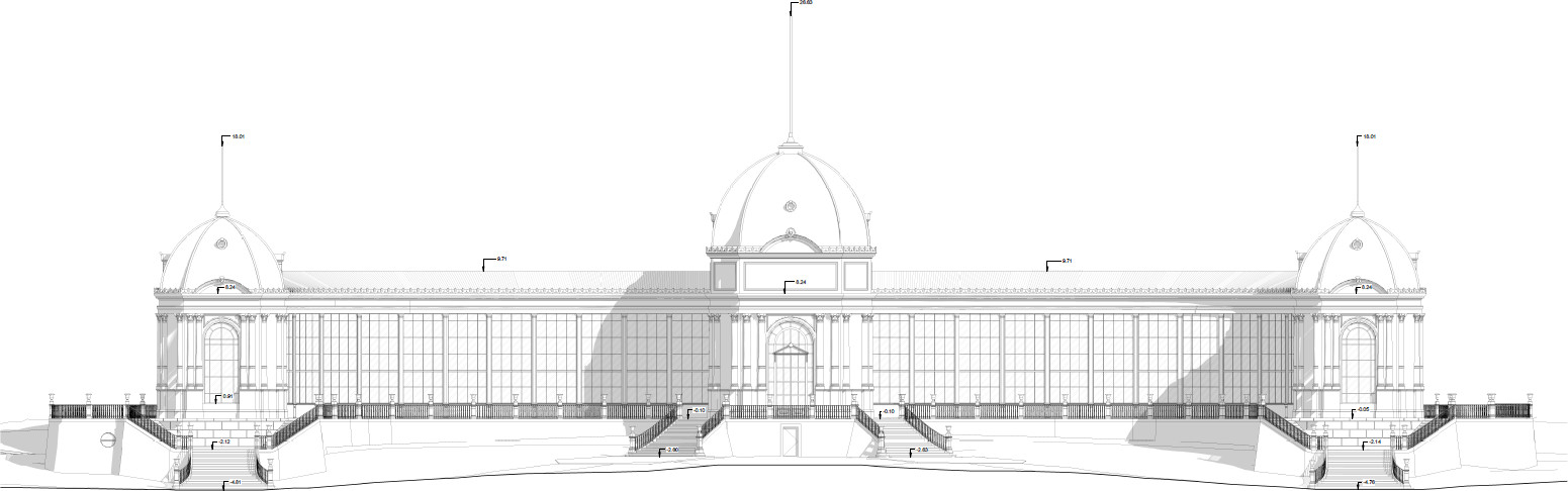
(2020) Surveying and modelling of "Pavilhão de Exposições" of ISA.ULisboa. This project consisted in the development of a scan-to-BIM methodology to document the building and to prepare the graphical documentation for the resotration project. This activity was framed by a cooperation protocol for research established between FA.ULisboa and ISA.ULisboa. Participants: Luís Mateus, Victor Ferreira, Jorge Fernández, Gustavo Rocha.
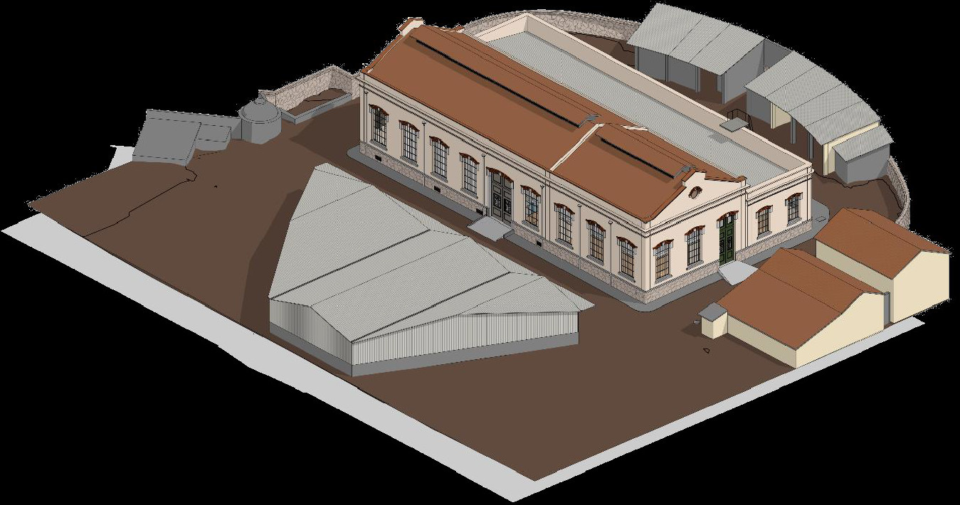
(2019) Surveying and modelling of "Geradora" building of ISA.ULisboa. This project consisted in the development of a scan-to-BIM methodology to document the building and to prepare the graphical documentation for the resotration project. This activity was framed by a cooperation protocol for research established between FA.ULisboa and ISA.ULisboa. Participants: Luís Mateus, Victor Ferreira, Jorge Fernández, Gustavo Rocha.
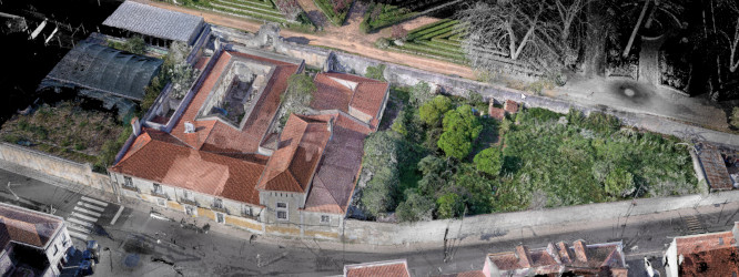
(2019) Surveying of the Museum of Natural History and Avelar Brotero house in the Botanic Garden of Ajuda. It was done a mixed survey using terrestrial laser scanning (TLS) and photogrammetry. Here you can do a walkthrough based on TLS panoramas. This was a cooperation protocol, for academic research, between FAULisboa and ISA-ULisboa. Participants: Luís Mateus, Victor Ferreira, Jorge Fernández.
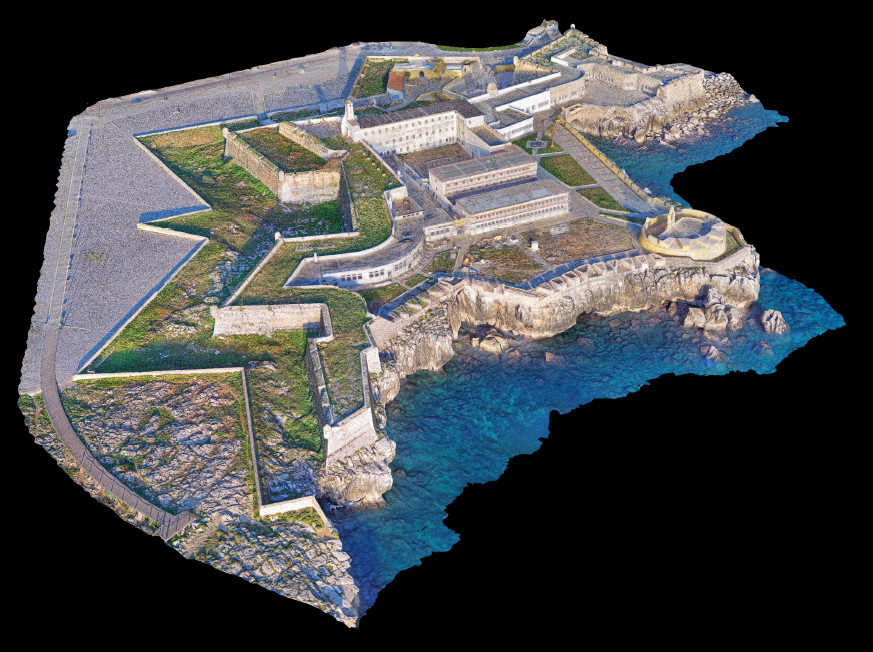
(2019) Surveying of the Fortress of Peniche. This was framed by a cooperation research protocol involving DGPC (General Directorate of Cultural Heritage) and FAULisboa. Here we developed and integrated strategy to produce a multi-scale survey using GPS, terrestrial laser scanning and photogrammetry with drone imagery. Participants: Luís Mateus, Victor Ferreira, Jorge Fernández, Camila Oliveira.
(2019) Surveying of the vault of the church of S. Cristovãoin Lisbon. This work was contracted by "Fábrica da Paróquia de S. Cristovão" to measure the geometric deformations of the vault. The survey was done using Terrestrial Laser Scanning. Participants: Luís Mateus, Victor Ferreira.
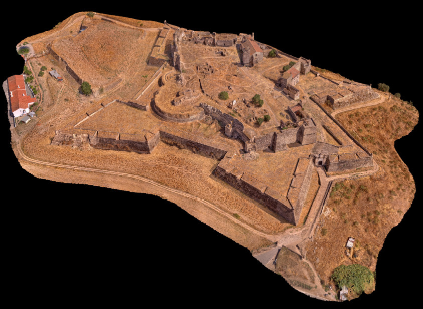
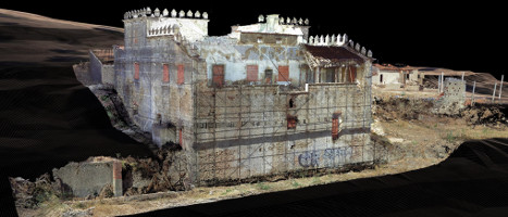
(2018) Surveying of the Fortress of Juromenha. Here we used terrestrial laser scanningand photogrammetry This was a cooperation with Pedro Pacheco Arquitetos and it was integrated in the restoration projec of the fortress. The final client was the municipality of Alandroal in Alentejo. Participants: Luís Mateus, Victor Ferreira, Jorge Fernández, Camila Oliveira.
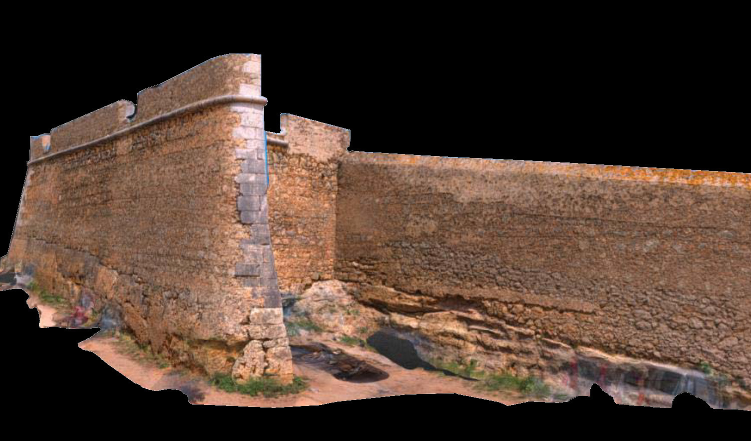
(2018) Surveying of the Historic Walls of Lagos. Here we used terrestrial laser scanning and photogrammetry. This was a cooperation with Pedro Pacheco Arquitetos and it was integrated in the restoration projec of the Walls. Participants: Luís Mateus, Victor Ferreira, Jorge Fernández, Camila Oliveira.
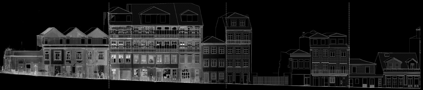
(2018) Surveying of 400 facades in the historic center of Porto. Here we used terrestrial laser scanning. This was commissioned by the municipality of Porto. Participants: Luís Mateus, Victor Ferreira, Jorge Fernández, Camila Oliveira.
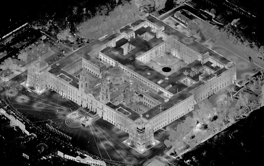
(2018) Laser scanning survey of National Palace of Mafra. This research involved DGPC (General Directorate of Cultural Heritage). Participants: Luís Mateus, Victor Ferreira.
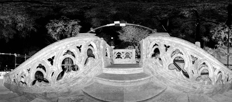
(2017) Surveying of stairs nearby Palácio Monserrate in Sintra. This work was contracted by Parques de Sintra, Monte da Lua. The survey was done using Terrestrial Laser Scanning. Afterwards CAD drawings were also done. Participants: Luís Mateus, Victor Ferreira,
(2016) Surveying of Palácio Valflores in Loures. This work was contracted by the Municipality of Loures. The survey was done using Terrestrial Laser Scanning, Photogrammetry and Hand measuring. The goal was to do generate data for the restoration planning. Participants: Luís Mateus, Victor Ferreira.
(2016) Surveying of Igreja da Graça in Évora. This work was contracted by Direcção Regional de Cultura do Alentejo (DRCA) and Exército Português (EP). The survey was done using Terrestrial Laser Scanning and Photogrammetry. It was also used a drone for aereal imagery. The goal was to do CAD drawings and ortho-images. Participants: Luís Mateus, Victor Ferreira, José Aguiar.
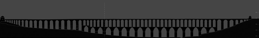
(2016) Surveying of Aqueduto de Pegões in Tomar. This work was contracted by the Municipality of Tomar. The survey was done using Terrestrial Laser Scanning, Photogrammetry and GPS positioning. It was also used a drone for aereal imagery. The goal was to do CAD drawings to be used for the structural rehabilitation works. Participants: Luís Mateus, Victor Ferreira, José Aguiar.
(2015) Surveying of the school Ducla Soares in Lisbon. This work was contracted by the Municipality of Lisbon. The survey was done using Terrestrial Laser Scanning and GPS positioning. The goal was to do CAD drawings to be used for the rehabilitation planning. Participants: Luís Mateus, Victor Ferreira.
(2012) Surveying of the exterior of Palácio de Belém in Lisbon. This work was contracted by the office of the President od the Portuguese Republic. The survey was done using Terrestrial Laser Scanning and aereal imagery collected with a ballon. The goal was to do generate data for the management of the property. Participants: Luís Mateus, Victor Ferreira.
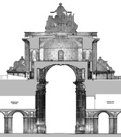
(2011) Surveying of Arco da Rua Augusta in Lisbon. This work was contracted by Parque Expo. The survey was done using Terrestrial Laser Scanning, topography for general control and Direct measurements. The goal was to do CAD drawings to be used for the rehabilitation planning by Arch. Alves Costa's office. Participants: Luís Mateus, Victor Ferreira, André Picaró, Ana Santos, Valeria.
ArcHC3D | © 2011 | Updated: 29/10/2024